Make the road part of the navigation system.
Intelligent Material can be embedded directly into ordinary road paint, thermoplastic markings and guidance strips. Vehicles, buses and people can then read information from the physical infrastructure itself - even where GPS, cameras or human vision are challenged.
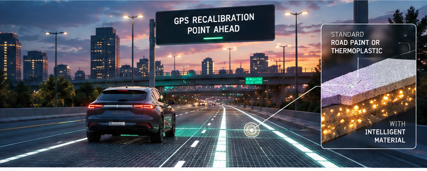 GPS RECALIBRATIONMACHINE-READABLE ROADWAY
Infrastructure that can tell a vehicle where it is.
Instead of asking every vehicle to infer everything from cameras, maps and satellites, Intelligent Material gives the roadway a machine-readable optical layer. Different compositions and patterns can carry location, lane, stop, alignment and guidance information while remaining visually unobtrusive.
GPS calibration
Known optical reference marks can confirm or correct vehicle position where satellite accuracy is degraded by buildings, trees or other urban conditions.
Lane + intersection intelligence
Encoded lane lines, stop bars, turn markings and intersection patterns can give vehicles direct physical reference points instead of relying only on image interpretation.
Speed + passage
Known-width perpendicular markings and multiple sensors can provide precise passage timing, location reference and road-relative speed information.
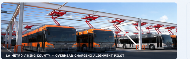
Bus charging alignment
Machine-readable roadway strips can guide electric buses into the exact position needed for overhead charging hardware.
Navigation for the visually impaired
A sensor-equipped cane can detect coded sidewalk and crosswalk markings for straight-line guidance, corner identification and bus-stop location.
Fog, darkness + degraded vision
Optical signatures embedded into normal markings can give dedicated sensors another channel when conventional computer vision is challenged.
The road can carry information.
The markings can still look and behave like ordinary transportation infrastructure. The difference is that an optical reader can recognize an engineered material signature and turn a physical location into useful digital information.
An invisible layer of intelligence.
Intelligent Material can be blended into standard paint, thermoplastic, tape or other surface materials. A dedicated optical sensor reads the response at speed and converts it into a known location, lane, intersection, stop or guidance event.
GreenPort + NovaVera: precision bus alignment.
The current program applies the same principle to a very practical problem: positioning an electric bus precisely beneath overhead charging hardware.
Let the roadway tell the driver when the bus is aligned.
The prototype uses Intelligent Material embedded in standard highway marking tape, read by a near-infrared optical sensor mounted underneath the bus. A dashboard device gives the driver a simple alignment indication.
The system separates the infrastructure into a few readable states - approach, alignment and stop - so the driver does not have to estimate the charger position from curb or mast references that may not exist in a depot.
Proven as a physical reference point for positioning.
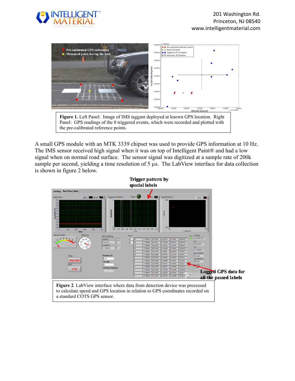
IMS worked with the Federal Highway Administration on vehicle-to-infrastructure testing using Intelligent Material embedded into roadway markings. The test program showed that the sensor could distinguish marked locations from normal roadway and use those known points as references for GPS calibration and vehicle passage.
The larger idea is straightforward: GPS provides global position; Intelligent Material supplies a local physical truth point. The two systems can complement one another rather than compete.
Cooperative guidance is protected.
The transportation platform is covered by IMS intellectual property spanning intelligent roadway coatings, vehicle sensing, location correction and pedestrian guidance.
Cooperative guidance system and method
The patent covers systems in which vehicles or pedestrians sense selected materials in roadways, sidewalks and other paved surfaces to determine location and support guidance. It specifically addresses intelligent paint, GPS correction, vehicle operating actions, sensor-equipped canes for the visually impaired, airfield guidance, warehouses, robotics and related physical-navigation systems.
Open in Google Patents →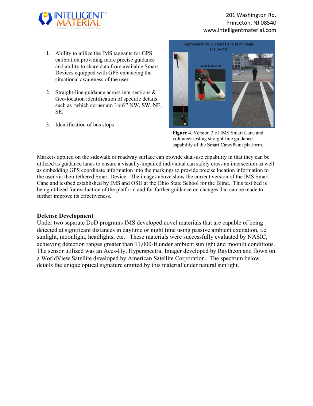
A sidewalk can become a navigation surface.
For a person who cannot navigate visually, GPS alone often cannot answer the questions that matter most at street level: Which corner am I on? Where does the crosswalk begin? Am I walking straight across it? Where is the bus stop?
IMS developed a sensor-equipped cane concept that reads unique optical signatures in sidewalk and roadway markings. Those physical markers can provide straight-line guidance across intersections, identify corners and bus stops, and connect precise local reference points to a tethered smart device.
Transportation is bigger than cars.
Once the physical environment becomes machine-readable, the same material-and-reader architecture can serve many mobility systems.
Aircraft + ground vehicles
Machine-readable runway, taxiway and service markings can provide another physical guidance layer for aircraft and airfield vehicles.
Autonomous material movement
Embedded floor markings can support routing, precise stops and traffic control for forklifts, robots and automated guided vehicles.
Landing + route references
Optical markers can provide unique local references for robots or drones when GPS is unavailable, degraded or too coarse.
One physical layer, many users
The same coded infrastructure can potentially serve vehicles, transit, pedestrians and municipal systems without adding visible clutter.
Give the road something useful to say.
IMS develops the Intelligent Material and intellectual property. NovaVera commercializes the systems, readers and transportation applications.